Vintage Highway 68 Whitefish Falls Ontario Aerial View Postcard
📸 Click any thumbnail to inspect Front, Back & Angles (2 Photos)
As an eBay Partner, we may earn a commission if you make a purchase.
Item Specifications
- Era: 1960s Chrome
- Publisher: Peterborough Post Card Co.
- Distributor: A. A. Gleason, Jr.
- Location: Whitefish Falls, Ontario, Canada
- Subject: Highway 68 Bridges & Aerial View
- Originality: Original Vintage
- Category: Postcards & Ephemera
- Format / Type: Vintage Postcards
Looking for Modern Alternatives?
Explore top-rated, modern Postcards & Ephemera and related historical accessories on Amazon.
Shop Postcards & Ephemera on Amazon →As an Amazon Associate, we earn from qualifying purchases.
Historical Context & Overview
A Mid-Century Aerial View of Whitefish Falls, Ontario
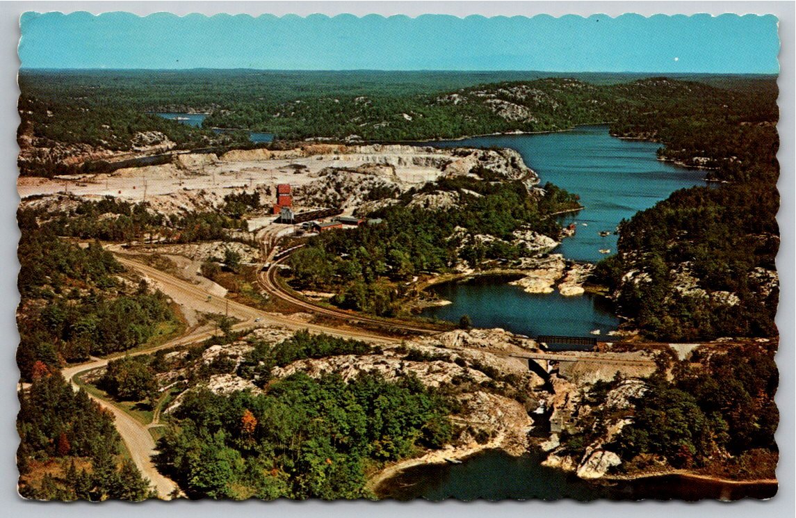
Capturing the rugged beauty of Northern Ontario's Precambrian Shield, this mid-century postcard offers a breathtaking bird's-eye perspective of Whitefish Falls and historic Highway 68. Situated along the dramatic transit route connecting Espanola on the mainland to Little Current on Manitoulin Island, this region has long served as both a crucial industrial corridor and a gateway for wilderness tourists exploring the iconic La Cloche Mountain range.
The aerial photograph provides a panoramic look at the intricate geography of the area, where granite outcroppings, pristine waterways, and dense pine forests intersect. Highway 68—which was later renumbered as part of Ontario's scenic Highway 6—winds past the river channels and concrete bridge spans that allowed motorists to navigate the challenging northern terrain during the mid-20th-century road building expansion.
Infrastructure, Industry, and the La Cloche Landscape
Beyond the natural waterways, the image offers a rich historical snapshot of regional industry. Visible in the backdrop is the distinctive quartz quarrying operation that defined the local economy for decades. The brilliant white silica and quartzite deposits of the La Cloche hills are prominently displayed alongside the rail spur lines operated by the Canadian Pacific Railway (formerly the Algoma Eastern Railway), which carried harvested materials and passengers through the region.
This intersection of natural topography and human engineering highlights a transformative era in Canadian infrastructure. As automobile vacationing exploded after World War II, routes like Highway 68 became vital lifelines for weekend anglers, campers, and cottagers traveling south toward the ferries at South Baymouth or north toward the Trans-Canada Highway.
Publisher and Collector Significance
This vibrant color card features the characteristic scalloped deckle edge popular on quality Canadian souvenir cards of the 1950s and 1960s. Produced by the Peterborough Post Card Company of Peterborough, Ontario, and distributed regionally by A. A. Gleason, Jr. out of South Bay Mouth, the card represents an authentic piece of Ontario commercial printing history.
For collectors of Canadian geography, industrial history, or transport ephemera, this postcard serves as an evocative visual record of Northern Ontario's transitional mid-century landscape. Its crisp aerial composition preserves the memory of Whitefish Falls before modern bypasses and re-alignments altered the highway's classic trajectory.