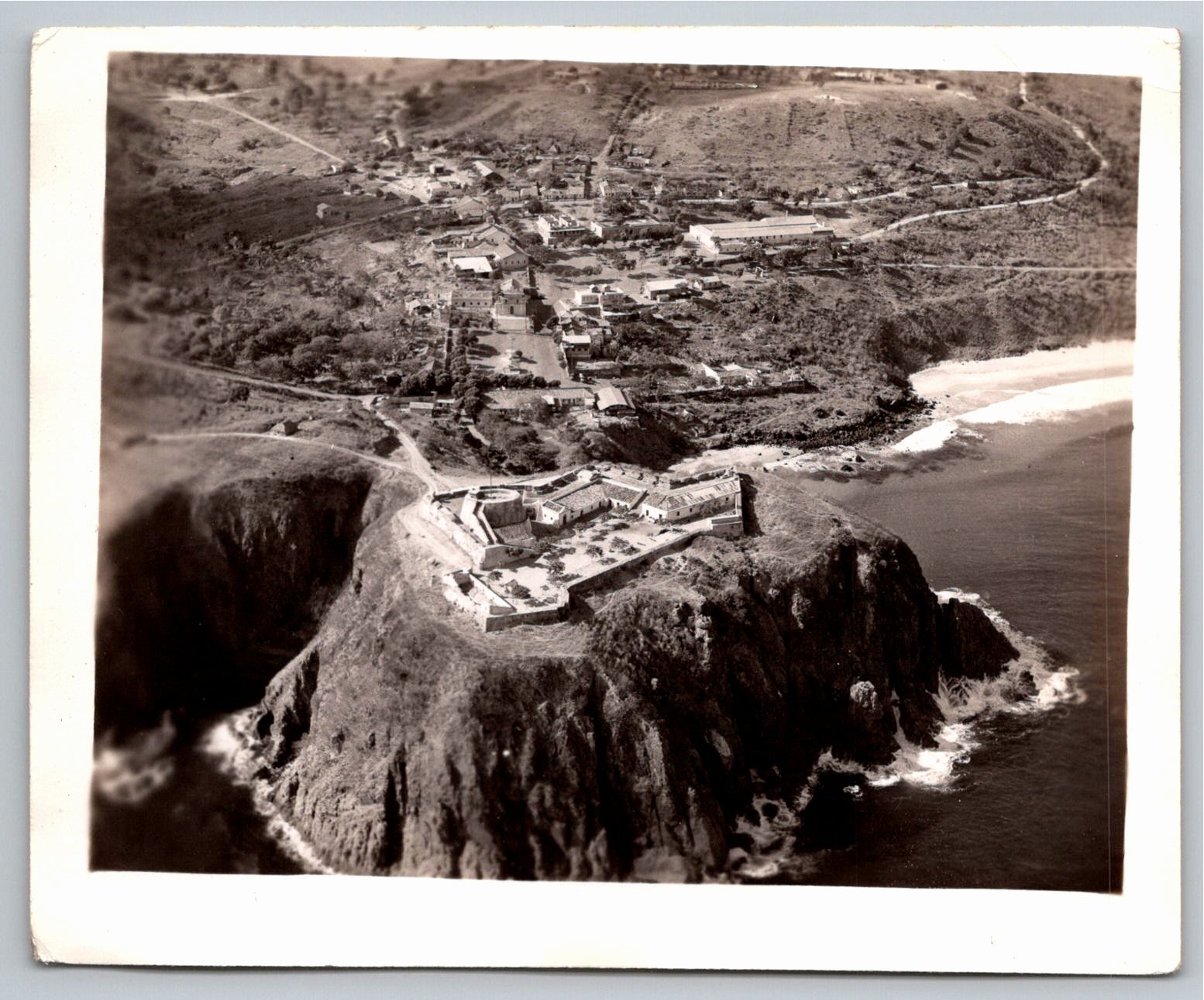
1940s Vintage Aerial Photo Coastal Cliff Fortress Bastion
📸 Click any thumbnail to inspect Front, Back & Angles (2 Photos)
🔗 Embed / Cite This Archival Image (Free with Attribution)Get HTML Code
© USA RESELL. Bloggers, historians, and website owners may embed this image for free by copying the HTML code below (which includes the required credit link back to this page):
USA RESELL is a living historical archive. Because original artifacts are one-of-a-kind and source records change rapidly, use the button above to check live marketplace availability or locate surviving examples. As an eBay Partner, we may earn a commission on qualifying purchases.
Item Specifications
- City: Unspecified
- Country: United States
- Era: Vintage (circa 1930s-1950s)
- Subject: Military Fortress Coastal Citadel Ocean Cliffs Aerial
- Theme: History
- Year of Production: 1940
- Category: Vintage Photography
- Format / Type: Vintage Photographs
Historical Context & Overview
Visual & Historical Overview: A Bastion Above the Ocean
From an elevated vantage point high above the breaking waves, this captivating original gelatin silver photograph presents an aerial perspective of an imposing coastal citadel. Erected atop a sheer, rugged cliffside, the stone fortification commands panoramic sightlines over the turbulent waters below. Massive masonry ramparts form an angular defensive perimeter around open courtyards, punctuated by a prominent circular observation tower and structured outbuildings designed to withstand naval bombardment and maritime erosion.
Extending inland directly behind the promontory, a sun-drenched coastal settlement unfolds across the rolling, semi-arid terrain. Networks of unpaved roads and dirt paths cut through the hillside, connecting scattered vernacular dwellings, civic buildings, and peripheral stone enclosures. The juxtaposition between the raw natural power of the crashing surf and the calculated permanence of defensive military engineering gives the aerial composition an enduring sense of vigilance and dramatic isolation.
Mid-Century Aerial Survey and Coastal Fortification History
Originating in the mid-twentieth century—dating from approximately the 1930s to the 1940s—this aerial print reflects the flourishing era of aerial reconnaissance, maritime topography, and coastal surveillance. During this period, military and civilian aviators utilized specialized handheld and mountable survey cameras to map coastal defense networks, remote harbors, and strategic waterways. Such flights provided vital geographical records, revealing architectural details invisible from ground level.
The fortification depicted exhibits classic bastion trace and battery architecture characteristic of centuries-old coastal installations repurposed or preserved through subsequent conflicts. While the specific geographical location remains an intriguing subject for regional historians and fort enthusiasts, the visual elements illustrate the enduring reliance on high-elevation bastions to safeguard coastal shipping lanes, sheltered anchorages, and adjacent coastal hamlets.
Physical Attributes, Archival Condition & Collector Significance
This authentic vintage physical photograph measures approximately 4.9 by 4.0 inches and is produced on traditional single-weight photographic paper with a smooth glossy finish. The print exhibits excellent tonal separation, capturing the deep shadows of the sea-facing rock walls, the frothing white foam of coastal breakers, and the subtle variations of the arid landscape. The reverse is entirely blank, free of commercial photograph markings or dividing lines, authenticating the piece as a standalone darkroom photographic print.
Carefully preserved across decades, the photograph remains in very good vintage condition, displaying crisp focus, gentle warm aging, and light, honest handling wear along the margins and corners commensurate with its era. Unmounted and untrimmed, it represents an outstanding archival artifact for collectors specializing in vintage military photography, coastal bastion architecture, maritime aviation history, and early aerial topography.