1955 Vintage Denison Dam & Lake Texoma USACE Sign Snapshot
📸 Click any thumbnail to inspect Front, Back & Angles (2 Photos)
🔗 Embed / Cite This Archival Image (Free with Attribution)Get HTML Code
© USA RESELL. Bloggers, historians, and researchers may embed this image for free by keeping the credit link below intact:
USA RESELL is a living historical archive. Because original artifacts are one-of-a-kind and source records change rapidly, use the button above to check live marketplace availability or locate surviving examples. As an eBay Partner, we may earn a commission on qualifying purchases.
Item Specifications
- City: Denison
- State: Texas
- Country: United States
- Era: Mid-Century (1950s-1960s)
- Subject: Denison Dam and Lake Texoma US Army Corps of Engineers Sign
- Theme: Transportation and Infrastructure
- Category: Vintage Photography
- Format / Type: Vintage Photographs
Historical Context & Overview
Mid-Century Engineering Captured on Silver Gelatin
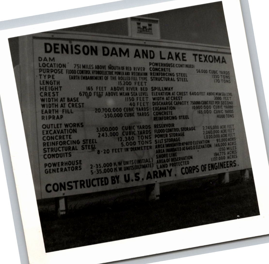
In mid-twentieth-century America, public infrastructure projects were celebrated not merely as functional utilities, but as monuments to human ingenuity and economic power. This original 1955 black-and-white snapshot offers a rare, focused look at the informative display board erected by the United States Army Corps of Engineers at the site of the monumental Denison Dam and Lake Texoma along the Texas and Oklahoma border.
Measuring 3.4 by 3.3 inches, this compact vintage photograph captured on glossy silver gelatin paper records the staggering technical data of one of the era’s greatest earth-fill dam projects. The high-contrast lettering prominently displayed across the large wooden signage reveals the monumental scale of civil engineering required to tame the turbulent Red River and provide flood control, hydroelectric power, and recreational waters to the surrounding region.
Building Denison Dam and Lake Texoma
Authorized by Congress under the Flood Control Act of 1938, construction on the Denison Dam began in 1939 under the supervision of the U.S. Army Corps of Engineers. Completed in 1944, the massive rolled-earth fill embankment stretched over 15,000 feet in length and rose 165 feet above the riverbed. At the time of its completion, it ranked among the largest earth-filled structures in the world.
The resulting reservoir, Lake Texoma, quickly grew into one of the Southwest’s largest artificial bodies of water, straddling Bryan and Marshall counties in Oklahoma and Grayson and Cooke counties in Texas. Beyond flood mitigation, the powerhouse generators detailed on the signage provided crucial energy to growing post-war industries throughout North Texas and southern Oklahoma, cementing the dam's vital role in regional economic modernization.
Details and Collector Significance
What makes this historical photo particularly compelling to regional history enthusiasts and photography collectors is the clarity with which the sign's engineering metrics remain legible. Details outlining earth fill volumes, spillway elevation, excavation totals in cubic yards, conduit diameters, and power output specifications can all be read directly off the sign face.
Physical Characteristics & Authenticity
Printed during the mid-1950s, the photographic paper exhibits authentic era-appropriate characteristics. The reverse side remains clean with natural, subtle border tone aging and a vintage ink stamp reading "556 A." The sharp contrast between the white timber framing and deep shadow grounds the subject matter in the authentic aesthetic of 1950s documentary snapshot photography.
As an authentic artifact of American public works history, this vintage gelatin-silver snapshot serves as a tangible bridge to mid-century industrial pride, capturing the proud legacy of the U.S. Army Corps of Engineers along the Red River boundary.