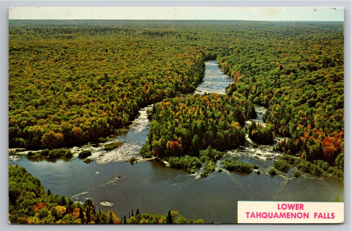
Vintage Aerial View Lower Tahquamenon Falls Island Michigan
📸 Click any thumbnail to inspect Front, Back & Angles (2 Photos)
As an eBay Partner, we may earn a commission if you make a purchase.
Item Specifications
- Type: Vintage Postcard
- Era: 1960s Chrome
- Publisher: The L. L. Cook Co.
- Location: Paradise, Upper Peninsula, Michigan
- Subject: Lower Tahquamenon Falls Aerial View
- Condition: Unposted
- Category: Postcards & Ephemera
- Format / Type: Vintage Postcards
Looking for Modern Alternatives?
Explore top-rated, modern Postcards & Ephemera and related historical accessories on Amazon.
Shop Postcards & Ephemera on Amazon →As an Amazon Associate, we earn from qualifying purchases.
Historical Context & Overview
Capturing Michigan's Upper Peninsula from Above
In the heart of Michigan’s wild Upper Peninsula lies one of the Midwest’s most celebrated natural wonderlands: Tahquamenon Falls State Park. While the roaring Upper Falls commands national attention for its vast width and dramatic drop, the Lower Falls offers an equally enchanting landscape—a cascading series of five smaller waterfalls flowing around a lush, forested island. This vintage chrome postcard captures a breathtaking aerial view of Lower Tahquamenon Falls Island, providing a rare perspective on how the river carves its path through endless wilderness.
The Mid-Century Photography of The L. L. Cook Co.
Produced from a vivid Ektachrome transparency, this postcard was published by the famed L. L. Cook Company of Milwaukee, Wisconsin. During the mid-twentieth century, as automobile culture boomed and family road trips became a national pastime, regional postcard publishers captured the pristine beauty of the Great Lakes region. The opening of the Mackinac Bridge in 1957 made the Upper Peninsula far more accessible to motorists, driving a surge in souvenir demand.
To produce compelling scenic view cards, photographers frequently took to the air in light aircraft. This elevated perspective highlights the rich, amber-tinted waters of the Tahquamenon River—colored by tannic acid leached from surrounding cedar and hemlock swamps—surrounding the dense island foliage as early autumn color begins to brush the forest canopy.
A Map to Northern Adventure
The reverse side of this postcard is rich with navigational detail, serving as both a souvenir and a localized travel guide. It features a printed schematic route map directing mid-century drivers along Highway M-123. The map connects local travel hubs including Newberry, Paradise, Whitefish Point, Eckerman, and Sault Ste. Marie, while noting key arterial links to U.S. 2 and U.S. 75.
The accompanying promotional text encourages visitors to take a boat trip out to the island itself, where footpaths allowed travelers to experience the rushing rapids up close. For collectors of Michigan history, mid-century road trip ephemera, and Northwoods scenery, this postcard offers a wonderful snapshot of Michigan's modern tourism heritage.